

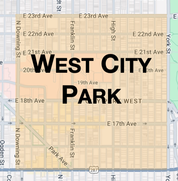
West City Park Neighborhood Page
Walk Score
85
Transit Score
52
The name of this neighborhood is obviously derived by its location being just West of City Park. The boundaries consist of Colfax Avenue to the South, 23rd Avenue to the North, Downing Street to the West and York Street to the East.
As the neighborhood’s name is derived by location, the same could be said about demand. There is high demand to live to such close proximity to City Park, but you also have to consider downtown and the abundance of local amenities. Those local amenities range from a dog park, a rec center, local eateries and watering holes on Colfax, 17th Avenue and 22nd Avenue.
The neighborhood is mostly comprised of Denver Squares and craftsman bungalows, but there are also some Victorians and ranch style homes. Along with City Park, you are near the Denver Zoo and Denver Museum of Nature and Science. There is also the St. Luke’s Presbyterian Medical Campus that is located on 14 city blocks. West City Park is also very biker friendly with numerous bike paths that lead into the city.
Mass transportation is also not a problem with numerous bus routes networking throughout the neighborhood. One last perk is that West City Park is entirely in East High School boundaries. Your child would be eligible to attend one of the better high schools in Denver. This can also help with home appreciation when it comes time to sell.
Bike Score
96